Visualize your GPX and KML files on the maps and charts with interesting statistics. Or choose locations on the map and draw the track to visualize it.
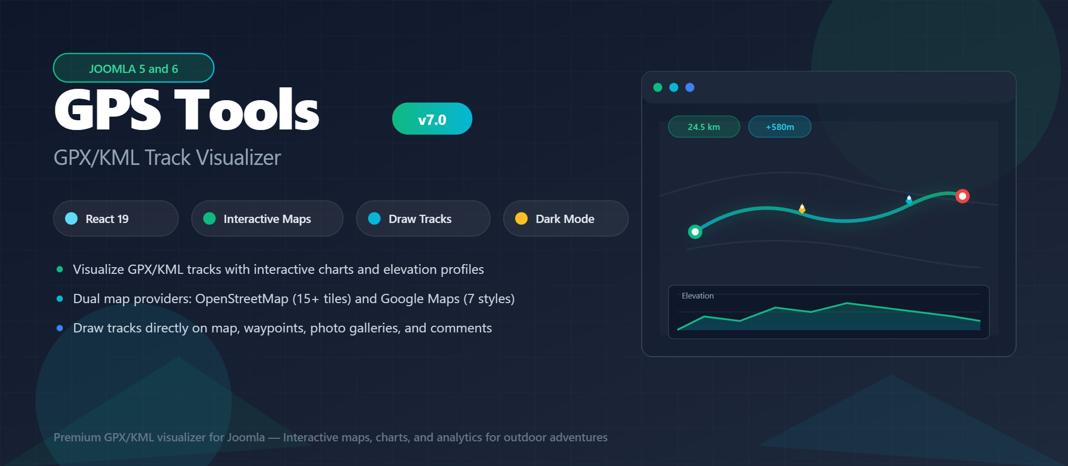
GPX and KML Support
GPS Tools supports GPX and KML files and visualize them on user-friendly maps and charts.
Google & Openstreet Maps
Supports both Google Maps and OpenStreetMap, you can choose the one which is most suitable for your site.
Draw on the Map
Don’t have a GPX/KML file, choose the points on the map and draw your own route and show statistics.
Beautiful User Interface
Build a beautiful forum page in minutes. Easy to build and easy to configure, get started in less than 5 minutes.
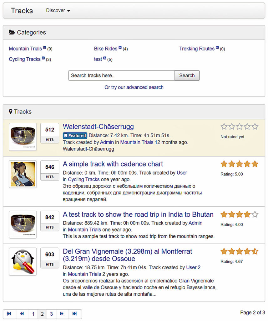
Category listing
Supports unlimited multilevel categories, displayed on a beautiful index page to easily navigate to the right forum.
Tracks listing with ratings
Shows the tracks with their avatars, hits, ratings, descriptions, and other must-needed elements. The listing screen is highly customizable.
Most useful toolbar
Get access to the most needed shortcuts with the thoughtfully designed toolbar. Get started quickly with all required buttons and menus in one place.
Visualize on the Maps
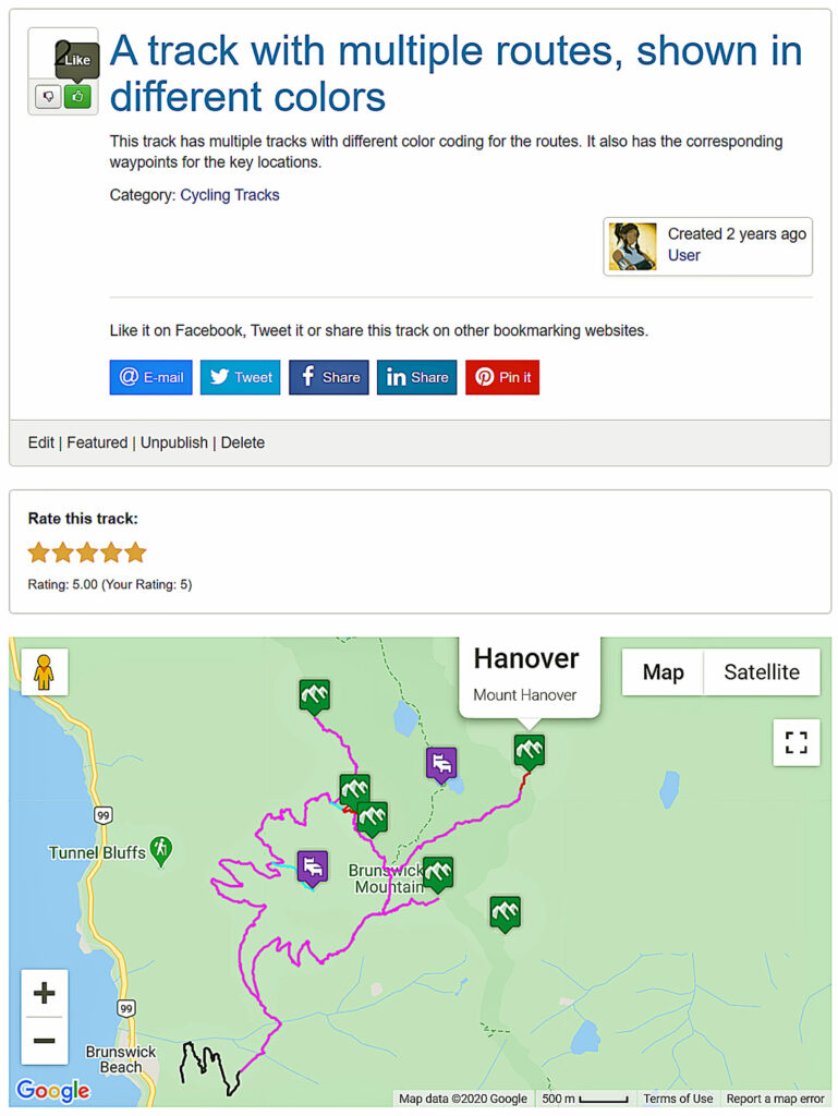
Draw your GPX/KML files on the interactive map which can support multiple track elements, icons, and more. The track description can be used to explain the detailed information and supports custom fields.
Google Maps & Openstreetmaps
GPS Tools supports both Google Maps and OpenStreetMap with Mapbox support. The maps services can be customizable with simple one-click options.
Support for multiple routes
A track may contain multiple routes and the component will automatically display them with different colors as you define in the file. The waypoints can be displayed along the routes as defined in your file.
Supports Tiles Layers
OpenStreetMaps tiles layers are supported. Switch the map tiles layer with configurable options and show relevant map views for your website.
Charts and Statistics
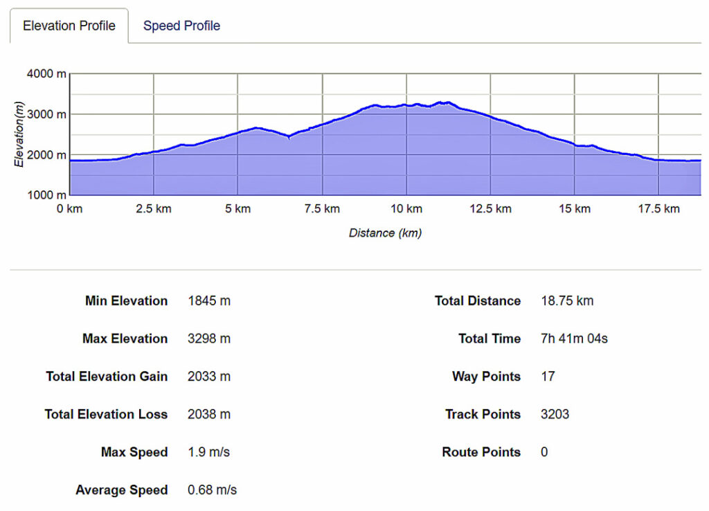
The tracks are automatically processed and the data is displayed on the interactive charts and statistics.
Elevation, speed & heart rate
GPS Tools can automatically detect and visualize the elevation, speed, and heart rate data if present in your track file. If the elevation service is used, it can automatically fetch the data from the web service.
Statistics
Quick statistics are automatically calculated and shown to you such as min/max elevation, distance, time, number points, and so on.
Waypoint Details
GPS Tools automatically detect and capture all waypoints and show their details on the track details page.
Waypoint details
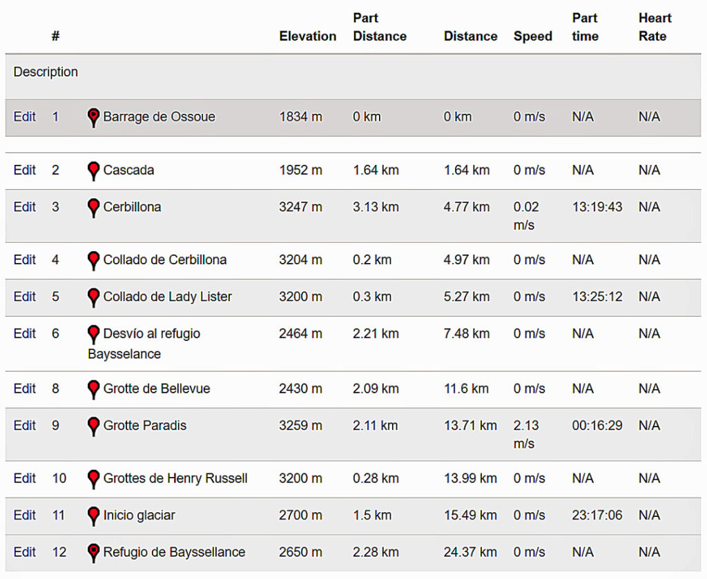
Each waypoint along with its statistics such as elevation, speed, time, distance heart rate at that point are shown on a tabular form for easy visualization.
Add and edit details
Track authors can view and edit the description of each waypoint and detailed information of the waypoint.
Suggestions & Comments
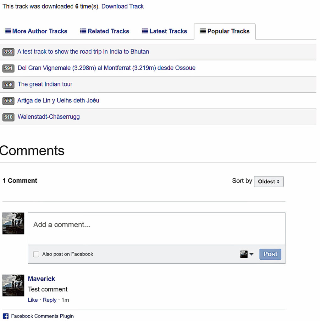
Show a list of other related tracks to users to keep the users engaged and post their comments.
Suggestions
A list of tracks submitted by the author of the current track, related tracks, latest and popular tracks can be shown on every track details page.
Comments
Integrate with popular commenting systems both Joomla and external systems such as Facebook comments, Disqus comments, IntenseDebate, JComment, Komento, JAComment, and CComment.
Custom Fields
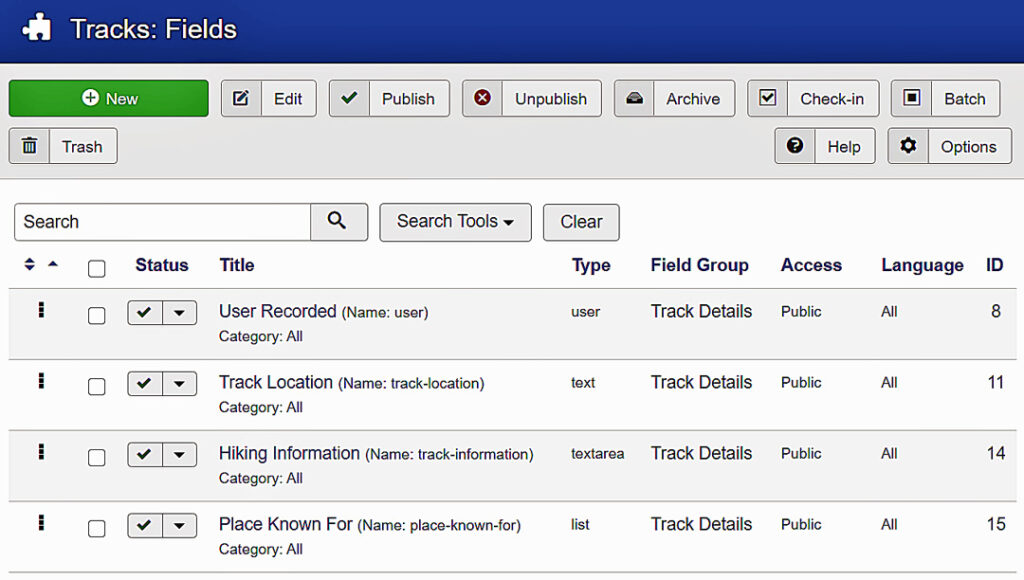
Add your own fields to the track details using Joomla! custom fields support. Group multiple fields into field groups.
All field types supported
Extend the functionality of the component with the custom fields support. All Joomla! custom fields and third-party fields are supported.
Fields and field groups
Group multiple fields into field groups and assign them to the component. Enter values during track creating/editing and they are automatically displayed on the track page.
Multilevel Categories
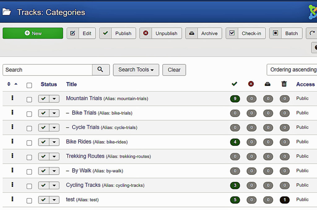
Create simple to most complex forum structure with unlimited, multilevel categories with built-in support for Joomla! category system.
Unlimited categories
GPS Tools utilizes Joomla! category system to build unlimited multilevel categories.
Category level permissions
Configure permissions at each category to allow the users to create tracks or to download them.
Track Builder & Form
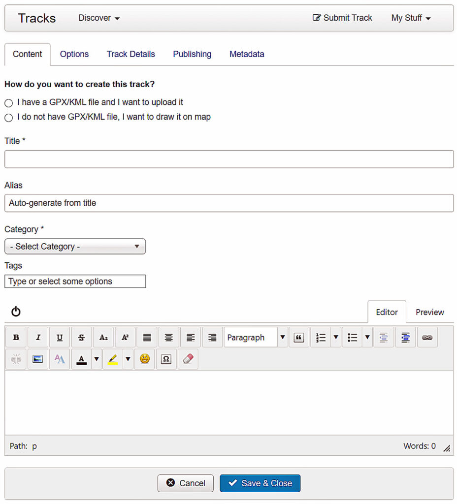
Quickly upload and create tracks from front-end and back-end. Track form supports creating custom routes.
Upload tracks
Upload GPX/KML file and add details and the component will take the rest of the job for you.
Custom routes
Choose the track file if you have one, or else draw a custom route by choosing waypoints on the map.
TESTIMONIAL
The All-in-One Tracks & Maps Extension
GPS Tools is the most popular and top-rated extension on Joomla! Extension Directory.
“It works well, looks professional and has a lot of options, perfect for a community website that has gps tracks – sailing, hiking, biking”
DAVEB
“The handling is intuitive and easy, even the older semesters are clear and appreciate GPS tools very much.”
PATRIK KONRAD
“Great support for every problem. Even if you need some modifications for your needs.”
MIDHAT BECAR
“Maverick’s support is incredible: very quick in the answers. Our requests for help have been resolved in a brilliant way and, above all, in”
MASSIMO
SUBSCRIBE
All Access Membership
No hidden costs, and no confusion. Get access to all our extensions with one simple membership.

